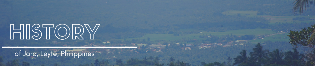
In the early time of the Spanish regime, the section where the Jaro is situated today was a lush forest enjoying its primitive freedom undisturbed by human beings.
In those days, struggles between Christianity and Mohammedanism took place. Datu Buisan and Sirungan led one of the Moro expeditions. They came to the Visayas leading a fleet of colorful moro vintas razing Christian towns to the ground, killing the inhabitants and taking some as slaves. Christians had to unite against the invaders and this was how Jaro came into being. There were two Leytenos known far and wide for their skill with the native arms and bravery in wars. These two men were Bonsilao of Ormoc and Sinirungan of Dagami. These two men were so strong that the people concluded that they possessed supernatural powers. This belief was strengthened by the fact that they managed to drive the Moros away. Later, the two men decided to settle in a centrally located place where they could easily give aid to the beleaguered Christians especially the inhabitants of Balugu, Kalgara and the neighboring towns. An ideal place was finally found. This was atop a hill and this same hill is where the parochial church of Jaro is situated. As time went by, the place was consequently cleared and homes were built. Small crooked paths were widened and thus a town was born.
The legendary background of this municipality has been for the most part connected with the surging Cabayongan River, which crisscrosses the town. This river had served the inhabitants in many ways, becoming as it were the flesh and blood of the community. As historical data points out, the municipality of Jaro was once called “Salug,” a proximate location to the Cabayongan River. Its fertile soil and abundant fruit-bearing trees contributed immensely to its early growth and expansion. It became a “visita” because of the periodic baptismal visit regularly made by the priest coming from the town of Barugo. This “Visita” became the second name of the municipality of Jaro.
In later years, the village became the centrifuge of people coming from the outlying districts and regions due to a running well found at the foot of the hill where the present church now stands, the water of which was believed to be medicinal because of herbs whose roots were leading to the well. The old folks termed the mixture of the herbs from the hill as “Haro,” a medicinal potent drug supposed to cure all kinds of afflictions and diseases. People from near and far municipalities flocked to this place to be treated.
Thus, ultimately, the word “Haro” became a by-word among the people and later on used to denote the name of the place when it became a municipality in 1810. When the Spaniards came, “Haro” was transcribed as “Jaro”.
Notre Dame of Jaro, a Catholic school run by the sisters of the Oblates of Notre Dame, is located in Jaro.
Jaro is a landlocked municipality in the coastal province of Leyte.
The municipality has a land area of 207.19 square kilometers or 80.00 square miles which constitutes 3.28% of Leyte’s total area. Its population as determined by the 2015 Census was 43,199. This represented 2.50% of the total population of Leyte province, or 0.97% of the overall population of the Eastern Visayas region. Based on these figures, the population density is computed at 208 inhabitants per square kilometer or 540 inhabitants per square mile.
The municipal center of Jaro is situated at approximately 11° 11′ North, 124° 47′ East, in the island of Leyte. Elevation at these coordinates is estimated at 104.0 meters or 341.0 feet above mean sea level.


+−3 km2 miLeaflet | © OpenStreetMap, PhilAtlas
Country levelTown levelView at OpenStreetMap
Distances
Based on the great-circle distance (the shortest distance between two points over the surface of the Earth), the cities closest to Jaro are Tacloban, Ormoc, Baybay, Catbalogan, Borongan, and Bogo. The nearest municipalities are Alangalang, Tunga, San Miguel, Pastrana, Santa Fe, and Barugo. Its distance from the national capital is 558.47 kilometers (347.02 miles). The following list delineates such distance measurements.great-circle distance
Nearest towns
- Alangalang, Leyte, 7.22 kilometers (4.48 miles) to the East‑Northeast (N74°E)
- Tunga, Leyte, 7.36 kilometers (4.57 miles) to the North‑Northwest (N26°W)
- San Miguel, Leyte, 12.80 kilometers (7.95 miles) to the North‑Northeast (N25°E)
- Pastrana, Leyte, 12.72 kilometers (7.90 miles) to the East‑Southeast (S63°E)
- Santa Fe, Leyte, 14.55 kilometers (9.04 miles) to the East (S89°E)
- Barugo, Leyte, 15.86 kilometers (9.86 miles) to the North‑Northwest (N18°W)
Nearest cities
- Tacloban, 25.39 kilometers (15.78 miles) to the East‑Northeast (N76°E)
- Ormoc, Leyte, 27.92 kilometers (17.35 miles) to the Southwest (S43°W)
- Baybay, Leyte, 56.60 kilometers (35.17 miles) to the South (S2°E)
- Catbalogan, Samar, 65.82 kilometers (40.90 miles) to the North (N10°E)
- Borongan, Eastern Samar, 85.06 kilometers (52.85 miles) to the East‑Northeast (N56°E)
- Bogo, Cebu, 85.57 kilometers (53.17 miles) to the West (S80°W)
Distance from Manila: 558.47 kilometers (347.02 miles) to the Northwest (N47°W)
National rankings
- Population (2015): 43,199, ranked 587 out of 1,634
- Land area (2007): 80.00 square kilometers, ranked 508 out of 1,634
- Population density (2015): 208 inhabitants per square kilometer, ranked 908 out of 1,634
- Annual population growth rate (2010 to 2015): 1.68%, ranked 1,382 out of 1,634
Notes
- Unless otherwise specified, population count (excluding percentages) and land area figures are derived from the Philippine Statistics Authority.
- Data on annual regular income is from the Bureau of Local Government Finance, Department of Finance
- Postal code information is from the Philippine Postal Corporation.
Source: https://www.philatlas.com/visayas/r08/leyte/jaro.html